


38 2022 08 05 Col du Lautaret-la côte belle

OLYMP42
User
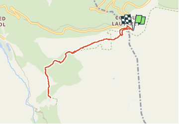

Length
8.4 km

Max alt
2131 m

Uphill gradient
189 m
Km-Effort
10.9 km

Min alt
2031 m

Downhill gradient
188 m
Boucle
Yes
Creation date :
2022-08-05 07:14:53.647
Updated on :
2022-08-05 10:06:38.459
2h19
Difficulty : Easy

FREE GPS app for hiking
 SityTrail
IGN / Geographical institutes
SityTrail Plus
The world is yours!
About
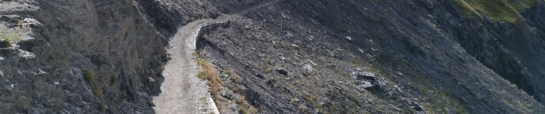
Trail Walking of 8.4 km to be discovered at Provence-Alpes-Côte d'Azur, Hautes-Alpes, Le Monêtier-les-Bains. This trail is proposed by OLYMP42.
Photos


Positioning
Country:
France
Region :
Provence-Alpes-Côte d'Azur
Department/Province :
Hautes-Alpes
Municipality :
Le Monêtier-les-Bains
Location:
Unknown
Start:(Dec)
Start:(UTM)
295813 ; 4989849 (32T) N.
Comments